


-

Structure of Protistan Parasites Found in Bivalve Molluscs
Frank O. Perkins
The literature on the structure of protists parasitizing bivalve molluscs is reviewed, and previously unpublished observations of species of class Perkinsea , phylum Haplosporidia, and class Paramyxea are presented. Descriptions are given of the flagellar apparatus of Perkinsus marinus zoospores, the ultrastructure of Perkinsus sp. from the Baltic macoma Macoma balthica, and the development of haplosporosome-like bodies in Haplosporidium nelsoni. The possible origin of stem cells of Marrteilia sydneyi from the inner two sporoplasms is discussed. New research efforts are suggested which could help elucidate the phylogenetic interrelationships and taxonomic positions of the various taxa and help in efforts to better understand life cycles of selected species.
-

Submerged Aquatic Vegetation in Delaware's Inland Bays
Robert J. Orth and Kenneth A. Moore
Submerged aquatic vegetation (SAV) is an important living resource in many coastal areas throughout the world. These plant communities have been cited as some of the most biologically important in the world. ...
-

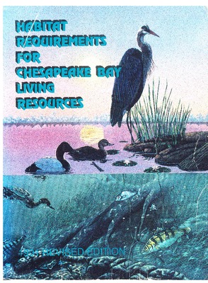
Submerged Aquatic Vegetation in the Chesapeake Bay: A Barometer of Bay Health
Robert J. Orth and Kenneth A. Moore
In 1978, a program was initiated in the Chesapeake Bay region to investigate the decline of submerged aquatic vegetation (SA V), potential factors that may have led to its decline, its distribution and abundance, and its .role and value. The program began with little available background data, but some very basic questions about SAV in the Bay were answered in the approximately three years of research that were funded. For example, it was determined that the decline of SAV was Baywide. All SA V species were affected and the decline was unprecedented in the recent history of the Bay. A second important finding was that the decline of SA V was most probably not related to any specific contaminant per se (e.g., herbicide contamination) but appeared to be related to deteriorating water quality in the Bay.
-
 by Harold H. Haskins and Jay D. Andrews")
Uncertainties and speculations about the life cycle of the eastern oyster pathogen Haplosporidium nelsoni (MSX)
Harold H. Haskins and Jay D. Andrews
For 30 years, the pathogen Haplosporidium nelsoni (MSX) has been causing serious mortalities of eastern oysters Crassostrea virginica in the Delaware and Chesapeake bays of the eastern USA. Its life cycle is largely unknown, and methods for control are wanting. Breeding of resistant eastern oyster strains, at this time, offers the best hope for some degree of control of the disease. Although haplosporidians are known by their spores, controlled transmission, with one possible exception, has not been achieved in any of the 30 recognized species. Haplosporidium nelsoni rarely sporulates in eastern oysters, and this and other observations led to early speculation that another host probably exists. Based on apparent effects of environment on H. nelsoni abundance, particularly in Delaware Bay, we are attempting to profile a hypothetical alternate host. Recent increases in abundance and activity of MSX in Chesapeake and Delaware bays and in Virginia rivers are associated with droughts, but this is not true elsewhere. Distribution of H. nelsoni along the Atlantic coast appears to have spread slowly southward from Chesapeake and Delaware bays, but is not identified with eastern oyster mortalities in southern localities. To the north of the original epizootics, H. nelsoni has been scattered along the Long Island, Connecticut, and Massachusetts coasts for 30 years or more, usually without occurrence of serious mortalities of eastern oysters. Foci of increasing H. nelsoni activity with mortality, over the past 5 years, are of great concern in these areas. Careful examination of changes in these northern areas may contribute significantly to our understanding of the relationships between H. nelsoni and its environment.
-

Use of immunoassays in haplosporidan life cycle studies
Eugene M. Burreson
The development of mitigating measures for the major oyster diseases has been hindered by our poor understanding of the life cycles of the pathogens. Evidence from epidemiological studies and transmission experiments suggests that an intermediate host is present in the life cycle of Haplosporidium species. Immunoassay is a valuable tool for identifying parasite antigen in an intermediate host, and, because of the potential for stage-specific antigens, assays incorporating polyclonal antibodies may be more effective than assays incorporating monoclonal antibodies. Rabbit antibody against purified spores of Haplosporidium costale recognized spores in paraffin sections of oyster tissue , but the antibody did not recognize plasmodia of H. costale.
-

Abundance of Virginia Shellfish and Finfish
Herb Austin
Water temperature, which has been measured from the pier at the Virginia Institute of Marine Science (VIMS) since 1946, has shown a steady upward trend since 1975-1976. This trend has been most dramatic during the fall-winter period, with October and November of 1984 and 1985 being two of the warmest periods in the 30-year record. The fall of 1985 was the warmest in 30 years. Winter (January-March) temperatures have also shown a steady rise since the record cold January-February of 1977-1978.
-

A Socio-Economic Overview of the Chesapeake Bay Fisheries
James E. Kirkley
The marine resources of the Chesapeake Bay are believed to provide substantial benefit to residents of the State of Maryland and Virginia. However, the possibility of overfishing and degradation of the marine environment seriously jeopardizes the possible benefit . In thsi section, a brief overview of the economic importance and characteristics of the Chesapeake Bay marine resources is presented. The potential for economic lossee are discussed relative to observed economic values.
-

Benthic Resources Of The Chesapeake Bay Estuarine System
Robert J. Diaz
The term benthic is derived from the Greek root " benth" which means the depths of the sea. Benthic has then come to mean that which is associated with the bottom of any body of water from lakes to oceans, and encompasses a broad range of organisms from algae to fish. In the Chesapeake Bay there is a wide variety and combination of benthic environments ranging from intertidal flats of sand or mud, shallow seagrass meadows, subtidal bottoms, and deeper channels. These environment take on a unique biological and chemical character, depending upon where they occur along the gradient of Bay salinities and sediment type.
-

Chesapeake Bay Fisheries: An Overview
Herbert M. Austin
The value of the marine resources of the Chesapeake Bay is second only to its value as a transportation corridor. The oyster, blue crab and striped bass or rock fish, along with the sailboat, epitomize our vision of the Bay. Nowhere else do such important renewable natural resources co-exist so closely to man's residential and industrial activities.
Over time, all natural resource distribution and abundance fluctuates in response to a normally fluctuating environment. Man's harvest adds an additional pressure, and in some cases recruitment levels cannot keep pace with consumer demand. In the Bay, pollutants, both intentional point source discharge, and unintentional non-point source run-off degrade the estuarine habitat and further reduce reproductive capabilities. Physical modification to the shoreline including bulkheading and filling, and daming of main tributaries such as the Susquehanna or James changes land run-off patterns thereby reducing the detrital energy source, and block spawning runs.
-

Contaminant Effects on Chesapeake Bay Finfishes
Ronald J. Klauda and Michael E. Bender
Habitat deterioration is consistent with perceived population declines for several resident and anadromous finfish species in Chesapeake Bay that are subjected to different levels of fishing pressure (e.g., striped bass versus blueback herring). Diminution of habitat quality has natural and anthropogenic roots that are difficult to separate. Recent contaminant effects studies focused on Chesapeake Bay fishes can be grouped as follows: (a) mathematical and statistical modeling studies aimed at elucidating contaminant and stock trend relationships using extant data and theoretical insights, (b) biological and chemical field surveys in selected areas to demonstrate spatio-temporal associations between levels of toxic organic and inorganic chemicals and absence or reduction of sensitive species, (c) measurements of condition factors and tissue residues of chemical contaminants in juvenile and older fishes, (d) laboratory studies of life stage and species sensitivities to an array of toxic contaminants, and ( e) in-situ field studies designed to measure the effects of habitat quality on specific life stages of selected species.
-

Contaminant Effects on Chesapeake Bay Shellfish
Michael E. Bender and Robert J. Huggett
The paper reviews contaminant effects on Chesapeake Bay shellfish from two avenues (1) adverse biological effects on the organisms and (2) fisheries closures due to bacterial and chemical contamination. The use of shellfish to monitor anthropogenic inputs of chemical contaminants is also discussed. Fisheries closures due to bacterial contamination account for the greatest economic loss due to man's activities. Kepone contamination in the James River, Virginia caused fisheries closures but has not appeared to cause biological damage to the resources. Organotin compounds from antifouling paints appear to pose a threat to Chesapeake Bay shellfish.
-

Contaminants in Chesapeake Bay: The Regional Perspective
George R. Helz and Robert J. Huggett
Industrial and municipal point sources of contaminants are scattered along the shores of Chesapeake Bay and its tributaries, but reach especially high density at Norfolk, Va., and Baltimore, Md. Sedimentation and various chemical processes in many cases conspire to restrict the water-borne transport of contaminant away from point source . Kepone, residual chlorine, volatile halogenated hydrocarbons, and anthropogenic trace metals are well-studied example of point-source contaminants. For the most part, their concentration in water and sediment drop to nearly immeasurable values within a distance of a few kilometers, or sometimes a few tens of kilometers, from their source .
On the other hand, certain contaminants have now been shown to be truly regionally dispersed. Included are polychlorinated biphenyls, phthalate esters, anthropogenic trace metal (Cu, Zn, Pb), polycyclic aromatic hydrocarbons, herbicides and weapon derived radionuclides. Most of these enter the Bay in significant amount from the atmosphere. Thus their dispersion throughout the Bay is not dependent on aquatic tranport processes. Although it is tempting to link the existence of this regional contamination with well publicized regional biological problem , no link has yet been proven.
-

Distribution and Abundance of Submerged Aquatic Vegetation in 1984 and 1985
James D. Simons and Robert J. Orth
Communities of submerged aquatic vegetation (SA V) are an integral part of the Chesapeake Bay ecosystem. They provide an important habitat for many species, either as a food source or as protection from predators, i.e., as a nursery. By reducing currents and baffling waves, they allow for deposition of suspended material. In addition, they bind sediments with their roots and rhizomes to prevent erosion of the underlying material. They are important in nutrient cycling through both the absorption and release of nitrogen and phosphorus.
-

Effects of Contaminants on Estuarine Zooplankton
Brian P. Bradley and Morrris H. Roberts Jr.
The objectives of the chapter are (1) to evaluate laboratory studies concerning effects of heavy metals, pesticides and oxidants on copepods, mysids, bivalve and decapod larvae (2) access field studies (mainly with copepods) on these and other contaminants which when coupled with laboratory data provide information on known and potential hazards of contaminants to zooplankton and (3) briefly review some bioassay methods used in these studies.
Mercury is the most toxic heavy metal by weight, followed by copper, silver and cadmium. Pesticides have been tested much less extensively than heavy metals. In general, bivalve larvae seem less sensitive than the crustacean taxa. Mysids, decapods and copepods seem comparable in sensitivity. Of the pesticides, tributyltin, an antifoulant, presents the greatest present or potential hazard. Chlorine, the most widely used oxidant in Chesapeake Bay, is highly toxic to all taxa reviewed, making zooplankton highly vulnerable. Lethal effects can be reduced or eliminated by dechlorination, but sublethal effects may persist.
-

Factors Affecting The Distribution And Abundance Of The Blue Crab In Chesapeake Bay
W. A. Van Engel
That environmental conditions in the Chesapeake Bay are optimal for the blue crab population is suggested by the fact that hard crab landings by Virginia and Maryland watermen accounted for almost 48% of the total of East and Gulf coast landings in 1985. Estimates of total mortality from the egg to the adult stage range from 0.999973 to 0.999996. Commercial fishing removes an additional 0.0000031 to 0.0000251, leaving 0.0000024 to 0.000001 as the rates of removal by other sources. Physical and chemical pollutants, predators, and plants and animals symbiotic with the blue crab are part of the environment that must be acknowledged as actual or potential factors affecting the rates of reproduction, growth and survival, and the behavior and distribution of the blue crab population. The impact of parasites and disease, predation, salinity, temperature, dissolved oxygen, heavy metals, polynuclear aromatic hydrocarbons, and halogenated substances on the blue crab are described . .
-

Mollusk Culture for the Chesapeake Bay
Michael Castagna
The water quality of the Chesapeake Bay has suffered a decline over the last 5 decades due to anthropomorphic activities. Insidious additions of industrial and farm pollutant to the Bay have created a situation where in many areas there are periodic sub lethal levels of chemicals. Although the juveniles and adults seem to survive these levels, they are obviously interfering with some early life stage of the living organisms that make up the bay fauna. Species whose early life history takes place out of the Bay (i.e. Cal!inectes sapidus) are less affected by this problem than those species whose eggs, embryos and larvae are found in the Bay.
Over 70,000 chemical are being manufactured in the United States today. Of the e approximately 50,000 are being produced in excess of 1.3 billion pounds annually.
-

Organic Chemicals in Sediments from the Lower Chesapeake Bay
R. J. Huggett and P. O. deFur
Many of the toxic organic chemicals affecting the marine environment are hydrophobic and associate with sediments. Sediments can accumulate the substances over long intervals and store them after the original source of the toxic material has been eliminated. Contaminated sediments can provide small but damaging amounts of the to.xicant to the overlying water for decades. For example, more than 10 years after the discovery of Kepone in the James River, Virginia, much of the James' fisheries ·is still closed because Kepone levels are above federal action levels.
-

Submerged And Emergent Aquatic Vegetation Of The Chesapeake Bay
Carl Hershner and Richard L. Wetzel
Chesapeake Bay supports a diverse assemblage of submerged and emergent aquatic vegetation. The distribution of species of each kind of vegetation is governed largely by salinity. The functions of both submerged and emergent vegetation in the Bay ecosystem includes contributing to total net primary production, service a habitat and performance in both water quality and sedimentation processes. Research on submerged aquatic vegetation is focused on its role in the estuarine system and determinants of its distribution and abundance. Research on emergent vegetation still concerns basic questions of structure and function, but has also branched into methodologies for utilization by man to meet water quality, erosion control and habitat objectives.
-

The American oyster Crassostrea virginica in Cheapeake Bay
Dexter Haven
The American Oyster (Crassostrea virginica) is widely distributed in Chesapeake Bay where it grows in the intertidal zone to depths of about 6.5 m. The salinity range over which it occurs, is from about 5 to 34 ° /oo. It is most abundant in protected embayments where bottoms are a firm sand-clay mixed with shelly material. This bivalve is a filter feeder, and ingests planktonic material which it strains from the water with its gills. Spawning occurs in Chesapeake Bay from June through September, and the eggs and resulting larvae are widely distributed during their 10-20 day planktonic life.
Growth and development, predators and diseases and oyster fishery are briefly discussed.
-

Dredging and Disposal in the Chesapeake Bay
Robert J. Diaz, Robert J. Byrne, and Linda C. Schaffner
The management questions involved in dredging and open water dredged material disposal revolve around three basic issues: 1) stability of the dredged material within the defined disposal area, 2) altered resource value of bottoms affected by dredged material, and 3) mobilization of toxins from contaminated dredged material. These issues encompass all aspects of the physical and biological character of a project site. The actual evaluation of dredging and dredged material disposal has generally concentrated on acute impacts to bottom dwelling organisms, benthos, and or to water column characteristics. This emphasis has resulted in ample evidence that many disposal practices have at least short term detrimental effects. With few exceptions, these studies have failed to assess the relationships between the benthos and the dredged material as a new sediment habitat, or the consequences of altering the hydrodynamic regime, or the resource value of the benthos.
-

Impacts of Alum Sludge on Tidal Freshwater Streams
Morris H. Roberts and Robert J. Diaz
Alum sludge, generated in the processing of surface water .for drinking water supplies, has traditionally been discharged into nearby streams in Virginia and elsewhere. Alum sludge contains aluminum in an insoluble and non-toxic form. There remains concern, however, that alum sludge may have a negative impact on receiving waters.
-

Man's Physical Effects on the Elizabeth RIver
Maynard M. Nichols and Mary M. Howard-Strobel
Man's ever increasing activities in the Elizabeth River, i.e. dredging, disposal of dredged material and waterfront development, have drastically altered the river floor, reshaped the shoreline and changed the circulation. Long-continued dredging of shipping channels, which is fostered by coal export, larger ships, and military needs, has moved 220 million cu yds of sediment since 1870. As a result channel depth has increased 1.8 fold, and maintenance dredging rates have doubled about every 35 years. Open water disposal released 40 million cu yds into Hampton Roads and lower Chesapeake Bay. Landfill buried tributary creeks, moved the waterfront into the river and reduced the river area by 27%. As a consequence of reduced area and greater channel depth, current velocity has diminished and near-bottom salinity likely increased. These conditions induce faster sedimentation that in turn, creates a need for greater maintenance dredging and hence, greater disposal. The dredge and fill cycle, therefore, is self-perpetuating. The long-term trends of channel deepening, enlargement, and landfill, are expected to continue in response to larger ships, military needs and projected sea-level rise.
-

Sandy Estuarine Fill Transported into the Mouth of Chesapeake Bay
C. H. Hobbs III, S. M. Cohen, and C. R. Berquist
The landward flux of sand into an estuary is a process that is seldom documented or quantified, yet is important to the sedimentary dynamics of a maturing estuary. Data from three recent studies converge to demonstrate the transport of sand into Chesapeake Bay from the adjacent shelf. A 100- year sediment budget, distributions of heavy minerals, and seismic-reflection data all point to the bay mouth as a gate through which a significant quantity of sand enters the estuarine system.
-

Storage Efficiency of Estuaries
Maynard M. Nichols
Estuaries or the U.S. Atlantic coast exhibit a range or storage efficiencies from complete storage to partial by-passing through the system. Efficiency, I.e. the ratio or sediment accumulation to river Input rate, ranges 0.7 in the Altamaha River, Ga. to 7.6 In the Choptank River, Md. Northern estuaries trap and store the bulk or their river input In addition to large amounts or sediment supplied from other sources. Southern estuaries accumulate major sediment loads in marshes and allow partial escape through channels to the sea.
The storage efficiency or difrerent estuaries is compared with respect to key factors that can be quantified and that vary within the region, It was round that storage efficiency in northern estuaries is encouraged by low flushing velocity and high volumetric capacity relative to river inflow. The long-term rise of sea level relative to the land tends to offset sediment accumulation and maintain or increase capacity. Within the range of estuaries considered, efficiency generally increases as the flow ratio decreases. This trend suggests the estuarine circulation in partially-mixed systems is important both in trapping fluvlal sediment and in transporting sediment landward from the sea.
-

Trace Element Contamination from Fly Ash Sites Near Chisholm Creek, VA
George C. Grant, Bruce J. Neilson, and Gene M. Silberhorn
The safe disposal of fly ash from power plants remains a concern because of dwindling available disposal sites and potential or actual environmental consequences. During the period from 1957 to 1974, the Virginia Electric and Power Co. station at Yorktown used a mixture of coal and refinery coke for power generation. The fly ash and bottom ash byproducts were disposed of in borrow pits which drain into Chisman Creek, a small estuary near the York River. In 1980 a domestic well near the pits turned green and tests revealed high concentrations of V and Se in some wells. Subsequently, contaminated wells were capped and homes were connected to the municipal water supply.
In late 1981 with a small.grant from the Virginia Environmental Endowment, we began a more detailed investigation of possible contamination from the pits. The sampling program included groundwater, surface water, estuarine water, flyash, soils near the pits, oysters and a variety of plants in the immediate vicinity. Most importantly, these samples were analyzed by PIXE (Proton-Induced X-Ray Emission), a sensitive and accurate multielemental technique which can simultaneously detect all elements from silicon to uranium without prior knowledge of the elements present.
-

Recent studies in the United States on parasites and pathogens of marine mollusks, with emphasis on diseases of the American oyster, Crassostrea virginica Gmelin
William J. Hargis Jr.
Morphological, systematic, faunal, and life cycle studies predominated research on marine parasites and pathogens in the United States before World War II. Much was primarily basic or academic in nature. Since then it has grown and diversified under pressure or efforts to: I) Increase yields or invertebrate-based fisheries, In nature and under controlled conditions; and 2) understand , protect, and improve the resources, estuarine and marine environments, and human health and welfare. Over the last 30 yr pathobiologlcal investigations of economically and ecologically important marine Invertebrates have broadened into submlcroscopcal anatomy (TEM and SEM technlques), physiology, Immunology, genetics, host-parasite ecology, Interactions between environmental pollution and disease, and prophylaxis and treatment of their diseases. Importation of foreign oysters (and other shellfish species) and their transfer and transplantation between the coastal regions, provinces, and states of North America have resulted in growing disease problems and a corresponding interest In the parasitology and pathology of the mollusks involved. It has also spawned efforts to control introductions and transfers. Two major diseases have been found to interfere with production or native Atlantic oysters along the Gulf and/or Atlantic coasts of the United States. These are the "Dermo" or "fungus" disease, caused by the apicomplexan protlstan Perkinsus marinus (both coasts) and "MSX" or Delaware Bay disease, caused by the sporozoan Haplosporidium nelsoni (the Atlantic coast-prlncipally in Chesapeake and Delaware Bays). Knowledge of lhese important epizootic-produclng diseases Is reviewed and discussed, along with that or other parasites and pathogen. of molluskan shellfish lo North America, and an extensive References section of the results or recent research on molluskan parasites and diseases is presented.
-

Kepone Uptake: A Comparison of Field and Laboratory Data
Micheal E. Bender, Robert J. Huggett, and Harold D. Sloane
The ability to predict the environmental fate and effects of pollutants in the marine environmenits of utmost importance in assessing the hazards posed by a compound's use and/or disposal. Most commonly utilized methods to establish potential environmental effects have involved an assessment with bioassays of a compound's acute and chronic toxicity. For compounds that have the ability to bioaccumulate, the potential dangers from this process must also be determined. A "first cut" estimate can be made by determining the partition coefficients between an organic solvent, usually n-octanol, and water. If this coefficient exceeds 25,000, EPA requires a report of the potential hazard (under the Toxic Substances Control Act), and further study is required. The next step is to expose some likely target animal to the suspected contaminant through food and/or water.
-

Meaningful Chemical Measurements in the Marine Environment - Transition Metals
James H. Carpenter and Robert J. Huggett
The following comments present a critical, but not negative, point of view that seeks identification of improved approaches to "marine pollution effects" studies. The current literature has many examples of the disquiet that the authors experience in reviewing or participating in recent studies. As pointed out by Dayton (1982), in reviewing the proceedings of a symposium: The Shore Environment, "Environmental protection programs are increasingly criticized by ecologists, regulatory and management agencies, and private business as being of questionable quality and value. Because regulatory agencies and many ecologists are uncomfortable with the highly probabilistic nature of ecology, there is a tendency, often a legal necessity, for impact studies to be very detailed and specific and to collect reams of data that have no underlying logic and defy generalization or test. This prevents the growth of coastal ecology as a science." It seems interesting and paradoxicaI that the collection of a large amount of data prevents the growth of a particular science, but it seems to be true.
-

How Can We Best Test The Effects Of Pollutants And Changes On The Animals And Plants Of Chesapeake Bay?
L. Eugene Cronin and Morris H. Roberts Jr.
The animals and plants of the Bay, and the processes in which they are involved, are the basis for almost every use and desirable quality of the Bay. They provide both commercial and recreational fisheries, assimilate some quantities of wastes, contribute to esthetic quality, provide a favorable environment for many birds and mammals and feed all of the species which are used by man. However, the biota are directly or indirectly affected by many human activities - by maritime transport, recreational activities, agricultural production, waste discharges, domestic development, engineering activity, and other land-based activities. Therefore, the ultimate and most important question to be considered in evaluating any new pollutant or proposed environmental modification is - What effect will it have on the biota?
-

How Do Sediments Enter The Bay, Move Through The System, Remove And Store Chemicals, Or Release Them?
Maynard N. Nichols
Escape of more than two million tons of sediment., 4,000 tons of man-made chemicals (e.g. Cd, Cu, Pb and Zn) and more than 300 types of synthetic organic compounds annually into the Bay, shoals shipping channels, reduces water quality and threatens biota. Where then do these enormous loads go? Are they mainly flushed into the sea or stored on the Bay floor? And what happens to chemicals attached to the sediments as they pass through different chemical regimes of the Bay? These are important questions facing scientists who aim to understand the cycling of sedimentary materials and to predict the fate of attached chemicals. These are also significant questions facing managers Concerned with causative agents, regional attributes of receiving waters as well as locating disposal sites.
-

How Should Research And Monitoring Be Integrated?
David A. Flemer, Thomas A. Malone, Herbert M. Austin, Walter R. Boynton, Robert B. Biggs, and L. Eugene Cronin
Scientific knowledge of Chesapeake Bay and tidal tributaries has accumulated over many years beginning mostly with descriptive surveys prior to the 1960's and 1970's and evolving towards a coupling of monitoring and research in recent years. This essay discusses the need to more fully couple monitoring and research efforts in the Bay system because such a union of efforts is argued to be the most effective way to assess gross trends in the "health" of the system (monitoring) and to understand the basic forces causing these trends (research). We argue that together they provide part of the framework necessary for effective management of the living resources of the bay region.
-

What Are The Best Guidelines For Dredging And Placement Of Dredged Materials?
Maynard N. Nichols
During the~ next 25 years, more than 280 millicm cubic yards of sediment will be dredged from the Chesapeake Bay and its tributaries (Table 1). Altogether more than 800 million dollars will be spent to deepen ports and maintain shipping channels. About one-third of the maintenance dredgin~; will be done in ports and harbors where the sediment is contaminated by industrial wastes and sewage discharge. Because of long-continued disposal of dredged material, the region is losing its physical capacity to assimilate more material. Where then can these enormous loads be placed at acceptable costs? And what are the best guidelines for selecting placement sites to accomodate polluted material? What guidelines are needed for predicting the short and long-term impacts of dredging and disposal? These are! important management questions facing bay scientists, engineers, and managers who aim to protect priority resources and at the same time to accomodate shipping that requires deeper channels and efficient navigation.
Printing is not supported at the primary Gallery Thumbnail page. Please first navigate to a specific Image before printing.
