


-

Measures Of Capacity In A Multispecies Danish Fishery
Neils Vestergaard, Dale Squires, and James E. Kirkley
Different measures of capacity utilization (CU) are applied to the Danish Gillnet fleet using the Data Envelopment Analysis (DEA) approach. The potential capacity output is found using the output-orientated measure. The CU measures are the partial capacity utilization measure and the Ray measure (DEA measure). The average CU of the Danish Gillnet fleet was found to be between 0.85 and 0.95 depending on the measure used. Since the Danish Gillnet fleet participates in a multispecies fishery regulated by TACs (output) the excess capacity was also found for each species. The results show higher excess capacity for cod and sole than for other species, which is in accordance with how the fishery developed. The variable input utilization was also estimated. On average, the variable input could have been increased by 27 percent in the period examined. Finally, the results are interpreted with respect to fishing area, port, vessel size and catch composition.
-

The Seagrasses of the Mid-Atlantic Coast of the United States
E. W. Koch and R. J. Orth
The mid-Atlantic region of the United States includes four states: Delaware, Maryland, Virginia and North Carolina. It is characterized by numerous estuaries and barrier- island coastal lagoons with expansive salt marshes and seagrass beds in most shallow-water areas. There are no rocky shores . Hard substrates are either man-made [rock jetties and riprap or wood pilings) or biogeniclly generated [oyster and worm reefs). Sediments are predominantly quartz sand in shallow exposed areas with finer grain sediments in deeper or well-protected areas . Marsh peat outcroppings or cohesive sediments are sometimes found in the subtidal areas adjacent to eroding marshes. Climatic variations are large with air temperatures ranging from - 10°C to 40°C and water temperatures ranging from 0°C to 30°C. Tides are equal and semi-diurnal but relatively small in range (maximum of 1.3 m during spring tides).
-

Tradeable Property Rights And Overcapacity: The Case Of The Fishery
Dale Squires, Yongil Jeon, R. Quentin Grafton, and James E. Kirkley
In fisheries, overcapacity is a critical problem that reduces rents and jeopardizes the sustainability of stocks. Using data from the British Columbia (BC) halibut fishery, before and after tradeable property rights were adopted in the harvesting sector, the paper tests for the effects of private rights on capacity and capacity utilization. The results indicate that tradeable property rights can be effective, even in the short-term, at reducing capacity per vessel per day and provide incentives to help overcome the "Tragedy of the Commons".
-

A Deepwater Dispersal Corridor for Adult Female Blue Crabs in Chesapeake Bay
Romuald N. Lipcius, Rochelle D. Seitz, William J. Goldsborough, Marcel M. Montane, and William T. Stockhausen
In marine ecosystems, there is no empirical evidence for the utility of dispersal corridors in conservation, despite widespread migrations by mammals, fish, and invertebrates. We investigated the potential for a deepwater dispersal corridor (> 13 m depths) in protecting adult females of the blue crab, Callinectes sapidus, en route from shallow-water nursery and mating areas to the spawning sanctuary in lower Chesapeake Bay.
-

Efficacy of blue crab spawning sanctuaries in Chesapeake Bay
Rochelle D. Seitz, Romauld N. Lipcius, William T. Stockhausen, and Marcel M. Montane
Sanctuaries can potentially protect a significant fraction of the spawning stock, and thereby sustain heavily exploited populations. Despite the worldwide use of marine and estuarine spawning sanctuaries, the effectiveness of such sanctuaries remains untested. We therefore attempted to quantify the effectiveness of the spawning sanctuaries for adult female blue crabs (Callinectes sapidus) in Chesapeake Bay. We used baywide winter dredge survey data to estimate the potential spawning stock prior to the major exploitation period, and summer trawl survey data to estimate spawning stock abundance within the Lower Bay Spawning Sanctuary and adjacent Bayside Eastern Shore Sanctuary during the reproductive period. Hence, we were able to approximate the percentage of the potential spawning stock that was protected by both sanctuaries after exploitation. On average, approximately 16% of the potential spawning stock survived to reach the Lower Bay Spawning Sanctuary and Bayside Eastern Shore Sanctuary. Even under a best-case scenario (i.e., crab residence time of 2 weeks), the sanctuaries only protected an estimated 22% of the potential spawning stock, which is well below the percentage recommended by recent stock assessments for sustainable exploitation (28%). In the worst case, a mere 11% of the potential spawning stock survived to reach the spawning sanctuaries. Hence, we recommend a substantial expansion of the spawning sanctuaries, as well as the complementary protection of other life stages in critical habitats, such as nursery grounds and dispersal corridors. Furthermore, traditional fisheries management measures (e.g., effort control) should be used in concert with sanctuaries to thwart impediments to effective implementation of the sanctuaries, such as redirected fishing effort.
-

Infection and mortality studies with Hematodinium perezi in blue crabs
Jeffrey D. Schields
Blue crabs, Callinectes sapidus, from the Delmarva Peninsula experience recurring epizootics of a pathogenic dinoflag ellate. The parasite, Hematodinium perezi , fulminates in late summer and autumn causing significant mortalities in high salinity embayments and estuaries. Mortality rates during epizootics a re difficult to estimate because dead crabs quickly deteriorate. Host mortality was investigated in naturally- and experimentally-infected crabs. Detection of the parasite, its proliferation in the hemolymph, and distribution in lower Chesapeake Bay were also examined. The dinoflagellate was highly pathogenic, killing 100% of naturally infected crabs, and 86% of inoculated crabs over 35 and 4 0 days, respectively. Inoculated hosts began dying 14 days after infection, with a median time to death of 30.3 + 1.5 d (se). Proliferation of the parasite was rapid at 20°C, with infections progressing to high levels over one to two week s. Detection of the parasite was, however, variable. In infection experiments so me hosts presented infections after two weeks while others were not detected until four weeks post inoculation. The dinoflagellate was prevalent in the seaside bays of the Delmarva Peninsula. In fall 1996, the prevalence of the disease along the Virginia portion of the Delmarva Peninsula varied from 20-50% in legal crabs. Prevalences of 1-30% were noted for crabs caught between Cape Henry and Cape Charles, i.e., the mouth of the bay. Th e mortality studies indicate that H. perezi represents a significant threat to the blue crab fisheries in high salinity estuaries and may preferentially infect mature females that move to higher salinities to breed .
-

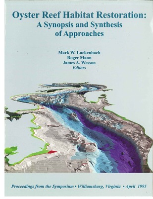
Chesapeake Oyster Reefs, Their Importance, Destruction and Guidelines for Restoring Them
William J. Hargis Jr. and Dexter S. Haven
The eastern oyster, Crassostrea virginica (Gmelin), can live any place in coastal marine and estuarine waters of the North American east coast offering suitable setting and survival opportunities. It occurs singly or in small clumps scattered widely but thrives best in colonial aggregations which, like those of tropical corals, are truly reefs. The massive self-renewing oyster reefs ("whole banks and beds") reported by early Chesapeake observers have yielded much. Without readily accessible oyster reefs the first English colonists of Jamestown might have starved. Without them the rich oyster industries of later years could never have developed.But oyster reefs benefitted the oysters that built and maintained them as well as the humans using them.
The oyster reefs of the Chesapeake region, including those on Seaside, developed during some 7,000-6,000 years of Bay evolution during the current (Holocene) Epoch. Until about 200 years ago reef oyster populations were able to maintain themselves and their reef habitats and withstand the inroads of biological enemies, other natural hazards and increasing harvests. By the late 1800s, Chesapeake public market oyster harvests had peaked and total market harvests and the oyster populations which provided them were in decline. more ...
-

Materials Processing by Oysters in Patches: Interactive Roles of Current Speed and Seston Composition
Deborah A. Harsh and Mark W. Luckenbach
Filtration rates for oysters have typically been measure in still water laboratory experiments and ecosystem-level effects estimated by extrapolation. With the exception of in situ measures of oyster filtration by Dame (1999, Chapter 18, this volume and references cited therein) these estimates have failed to account for the effects of hydrodynamic effects on oyster filtration rates and on physical redistribution of particles. In this chapter we report on a series of experiments conducted in a recirculating seawater flume designed to address the effects of flow speed and seston composition on filtration rates in a bed of oysters. In six separate experiments ninety oysters were arranged in the bed of the flume, flow speed adjusted to one of eight levels (0.65, 1.0, 2.1, 4.2, 6.0, 10.4, 13.7 or 22.0 cm s·1 ), seston added to the flume and particle concentrations upstream and downstream of the oyster bed determined from vertically-arrayed samples. Four experiments investigated the effects of each flow speed on the filtration of a unialgal diet, while two experiments utilized the algal diet in combination with inorganic particles. Control experiments sought to estimate the effects hydrodynamic effects on particle distribution by measuring "filtration" rates over beds of ninety pairs of empty oyster valves. Our findings reveal effects of flow speed and, less evidently, seston composition on particle filtration by oysters. More importantly, our results point to the importance of hydrodynamically-mediated particle redistribution of particles over patches of oysters, and portend sampling difficulties associated with quantifying oyster filtration rates in the field.
-

Oyster Restoration Efforts in Virginia
James Wesson, Roger L. Mann, and Mark Luckenbach
Long-term restoration of the Virginia Oyster resource has been assisted by a series of governmental and regulatory initiatives. Following the 1990 Blue Ribbon Panel the Virginia Marine Resources Commission set as goals that the oyster resources and oyster fishery would be so managed as to achieve (a) no net loss of existing standing stock of the native oyster over the next five years, and (b) a doubling of the existing standing stock of the native oyster over the next ten years. The 1994 Chesapeake Bay Aquatic Reef Plan and Oyster Fishery Management Plan both recommended the creation of 5,000 acres (2024 hectares) of oyster reef habitat during the 1995-2000 period. Practical progress toward this goal has been made through the development of several programs including direct application of substrate (cultch) to extant oyster reefs to facilitate settlement and recruitment, enhancement of reefs of the Seaside of the Eastern Shore by exhumation of buried shell, and construction of elevated reef structures in the Virginia subestuaries of the Chesapeake Bay. Efforts in the James River have included subtidal berm type structures capped with shell and a reef constructed entirely of shell. A shell reef has been constructed in the Piankatank River, and construction of several more is planned. All reefs remain as brood stock sanctuaries. Continuing management is supported by quantitative stock assessment.
-

Proceedings of special symposium, Research on Recreational Fishes and Fisheries : March 12, 1999
John E. Olney and Jack Travelstead
- The Saltwater Fishing License and Fisheries Management in Virginia / Jack Travelstead
- The Economic Valuation of Saltwater Angling In Virginia or Wouldn't You Rather Be Fishing? / James E. Kirkley, Nancy Bockstael, K.E. McConnell and Ivar E. Strand
- Facilities for ageing Virginia's marine catches / Jack Travelstead, Cynthia Jones and Steve Bobko
- Habitat-specific occurrence of juvenile Summer Flounder in Chesapeake Bay and the implications for conservation management / Richard Kraus and Jack Musick
- Feeding habits of large striped bass in Chesapeake Bay / John Walter and Herb Austin
- Importance of natural and restored seagrass beds in lower Chesapeake Bay as nursery habitat for recreationally important finfish species / Bob Orth and Jacques Van Montfrans
- Genetic analysis of population structuring within Spanish mackerel / V.P. Buonaccorsi, E.A. Starkey, and J.E. Graves
- Stock structure and age-specific migration patterns of weakfish (Cynoscion rega/is} along the US Atlantic coast / Simon Thorrold and Cynthia Jones
- Mycobacteriosis of striped bass from Chesapeake Bay / Wolfgang Vogelbein*, David Zwerner, Howard Kater, Martha Rhodes and Jennifer Cardinal
- Cobia (Rachycentron canadum) in Chesapeake Bay: age, growth, reproduction and management options for the recreational fishery / John Olney and John Hoenig
- Assessment of Fishing Mortality for tautog in Virginia / Geoff White, Jim Kirkley and Jon Lucy
- Ecology and Management of Sharks in Virginia / Jack Musick and Dean Grubbs
-

Small-Scale Patterns of Recruitment On A Constructed Intertidal Reef: The Role of Spatial Refugia
Ian K. Bartol and Roger Mann
Traditional oyster repletion activities have utilized a two-dimensional approach to shell (substrate) deployment to attain maximal coverage in subtidal locations with little consideration for optimal thickness of deployed shell and tidal elevation. Vertical dimensionality may play a vital role, however, in the establishment and persistence of oyster communities. Therefore, a three-dimensional oyster reef was constructed in the Piankatank River, Virginia, and settlement and mortality patterns of oysters were recorded from June of 1993 through September of 1994.
-

The Evolution of the Chesapeake Oyster Reef System During the Holocene Epoch
William J. Hargis Jr.
The oyster industries of Virginia and Maryland were based upon adult and juvenile oysters, and their shells, produced naturally on the reefs of the Chesapeake oyster reef system. Without those reefs the billions of bushels of live oysters and shells taken by humans could neither have been produced naturally nor harvested and the valuable social and economic activities derived therefrom would never have occurred.
The origin and development of the formerly massive, naturally self-renewing Chesapeake reef system were directly associated with the evolution of the Bay. Its destruction can be linked primarily to the increase of humans around the Bay and beyond and their demand for oysters and shells. Both phases, development and destruction, of reef history have occurred during the last three-quarters to twothirds of the post-glacial Holocene period, around 7,000 years or less. more...
-

Use of Dredged Material for Oyster Habitat Creation in Coastal Virginia
Walter I. Priest III, Janet Neslerode, and Christopher W. Frye
Dredging can have a beneficial effect on oyster habitat when the placement of the dredged material is effectively managed to help provide the bottom structure necessary to develop an oyster reef. Construction and maintenance of the Waterway on the Coast of Virginia (WCV) by the U. S. Army Corps of Engineers (Corps) has provided a number of examples of this process, both serendipitous and deliberate. The historical development of reefs that evolved from the random overboard placement of dredged material and the subsequent leasing of these areas for oyster cultivation is reviewed. A monitoring plan for the development of a reef in Swash Bay using maintenance dredging material is also described including pre- and post-dredging hydrographic surveys, surface sediment distributions, and shellfish surveys.
After one year, the benthic communities at the recently used placement site, the historical placement site and an unimpacted area in Swash Bay were compared using the Benthic Assessment Method (BAM) to determine short-term impacts. The historical and unimpacted sites had very similar values while the recently used site was somewhat lower. Consequences of continued success in developing oyster reefs in close proximity to a dredged channel are addressed with a suggested management plan that involves rotating the placement among a number of sites. This would allow for the continued maintenance of both the channel and the adjacent oyster reefs.
-

Hydrodynamics and equilibrium sediment dynamics of shallow, funnel-shaped tidal estuaries
Carl T. Friedrichs, Bruce A. Armbrust, and H. E. deSwart
-

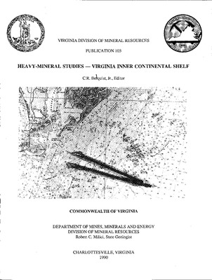
Submarine Sand Resources, Southeastern Virginia - Contributions from Year Nine and Year Ten of Virginia’s Continental Margins Program
Carl Hobbs III, C. Scott Hardaway Jr., and C. R. Berquist
Virginia’s Year-Nine and Year-Ten funds from the Continental Shelf Program were used to supplement other work funded by the Minerals Management Service in an ongoing Cooperative Agreement focused on the area offshore of southeastern Virginia. Year-Nine and Year-Ten funds facilitated interpretation of subbottom profiles and the analysis of sediment samples from cores and grabs. On Virginia’s sediment-starved continental shelf, deposits of material potentially suitable for use as beach nourishment or, perhaps, as construction aggregate occur in three stratigraphic settings, each with specific characteristics of morphology, grain-size gradients, likelihood of discovery, and physical ease of exploitation. All must be verified with a careful program of coring. Modern shoals generally are easier to identify, prove, and access than either filled channels or lenticular facies. Shoals usually are identifiable on nautical charts and characteristically have a definite lower boundary that can be seen in subbottom profiles. In most cases, the base of the shoal coincides with the level of the surrounding sea floor. Filled channels are readily identifiable on subbottom profiles but may have a narrow, sinuous form and steep lateral gradients in sediment properties. Buried lenticular facies of good-quality sand usually are found only fortuitously. As the lateral and often vertical gradients in geotechnical properties usually are low, the lenticular facies can be mined with a lesser concern for the consequences of violating the deposit’s limits than with the other two types of deposit. (more ....)
-

Effects of channel geometry on cross sectional variation in along channel velocity in partially stratified estuaries
Carl T. Friedrichs and John M. Hamrick
Analytic solutions for along‐channel velocity through an estuarine cross‐section with laterally varying depth are compared to observations from an array of current meters deployed over a nearly triangular cross‐section of the James River estuary. Analytic results suggest that the transverse structure of along‐channel velocity at this cross‐section is primarily due to simple density‐driven circulation modified by bathymetry. Comparisons of analytic solutions for the amplitude and phase of tidal velocity to observations suggest that linear models which include realistic lateral depth variation should also incorporate across‐channel variation in eddy viscosity. Solutions for various contributions to mean velocity are then derived which incorporate a power‐law dependence of eddy viscosity on local depth. Comparison to observations from the James River suggests that density‐induced circulation is the dominant contribution to along‐channel mean velocity and that riverine discharge also provides a measurable contribution. Nonlinear tides may account for much of the remaining discrepancy between observations and the linear analytic solution. Finally, applications of an existing three‐dimensional numerical model of the James River suggest (i) that inclusion of Coriolis acceleration does not greatly effect the cross‐sectional distribution of along‐channel mean velocity, and (ii) that the form of across‐channel variation in eddy viscosity in the analytic model is consistent with the behavior of the numerical model's more sophisticated turbulence closure scheme.
-

Uniform Bottom Shear Stress and Equilibrium Hyposometry of Intertidal Flats
Carl T. Friedrichs
Hypsometry is the distribution of horizontal surface area with respect to elevation. Recent observations of tidal flat morphology have correlated convex hypsometry with large tide ranges, long‐term accretion and/or low wave activity. Concave hypsometry, in turn, has been correlated with small tide ranges, long‐term erosion and/or high wave activity. The present study demonstrates that this empirical variation in tidal flat hypsometry is consistent with a simple morphodynamic model which assumes tidal flats to be at equilibrium if maximum bottom shear stress (τ) is spatially uniform. Two general cases are considered: (i) dominance of τ by tidal currents, where τ is equal to maximum tidally‐generated shear stress (τT), and (ii) dominance by wind waves, where τ is equal to maximum wave‐generated shear stress (τW). Analytic solutions indicate that a tidal flat which slopes linearly away from a straight shoreline does not produce a uniform distribution of τT or τW. If the profile is adjusted until either τT or τW is uniform, then domination by tidal currents favors a convex hypsometry, and domination by wind waves favors a concave hypsometry. Equilibrium profiles are also derived for curved shorelines. Results indicate that an embayed shoreline significantly enhances convevity and a lobate shoreline significantly enhances concavity — so much so that the potential effect of shoreline curvature on equilibrium hypsometry is of the same order as the effect of domination by τT or τW.
-

Utilization of Seagrass Habitat by the Blue Crab, Callinectes sapidus Rathbun, in Chesapeake Bay: A Review
Robert J. Orth, Jacques Van Montfrans, Romuald N. Lipcius, and Karen S. Metcalf
Seagrasses are generally presumed to provide important habitats for numerous species of vertebrates and invertebrates, serving as a nursery, structure for attachment, or foraging area. However, few species appear directly dependent on seagrass, one notable exception being the bay scallop, Argopecten irradians Lamarck. Research in Chesapeake Bay on the abundant, and commercially exploitable blue crab, Callinectes sapidus Rathbun, over the last decade, focused on the relevance of seagrass habitat for the overall population. Our research has demonstrated: I. higher densities of juvenile blue crabs in seagrass habitats compared to adjacent marsh and unvegetated areas, 2. seagrasses to be an important settlement habitat for recruiting post-larval blue crabs, and 3. mediated predatorprey interactions related to seagrass abundance and increasing crab size. Our current research focuses on the importance of restored areas for blue crab survival and relevance of seagrass habitat baywide in the context of landscape distributional patterns and metapopulation dynamics. Our findings suggest that similar habitats may differentially affect the numerical abundance of juvenile blue crabs. Elucidating the mechanistic reasons for the value of seagrass habitat for blue crabs, one of the last remaining, viable commercial fisheries in Chesapeake Bay, will be crucial in developing strategies for protecting and restoring seagrass habitat in Chesapeake Bay.
-

Economic Aspects Of The Chesapeake Bay Oyster Fishery: Problems And The Future Or Should The Industry Be Revitalized?
James E. Kirkley and Douglas Lipton
Between 1930 and 1939, average annual landings of Crassostrea virginica from Chesapeake Bay was 32 million pounds (meat weight). During the period 1980-88, average annual landings declined to 14.6 million pounds. In 1990, landings declined to less than 3 million pounds of meats. It has been this consistent downward trend in landings, particularly since 1983, that has concerned that National Marine Fisheries Service, various state agencies, and members of the oyster industry. In response to declining harvests, the National Oceanic Atmospheric Administration Sea Grant Program in cooperation with the National Marine Fisheries Service and various state agencies and sea grant programs developed A Plan Addressing the Restoration of the American Oyster Industry. The plan recommends that roughly $3 million annually allocated between 1991 and 1995 for research dedicated to restoring the oyster industry. A proposed $15 million budget raises two important issues that must be addressed: (1) should the industry be revitalized, and (2) if so, what needs to be done. In this paper, we offer that revitalization depends upon the marketability of oysters. A nationwide survey of wholesalers conducted in 1992 suggests that consumer demand for oysters has dramatically declined. Alternatively, oysters may be nearing the end of their product life cycle or going the way of the Edsel, IBM personal computer, or Yugo. Industry revitalization efforts, therefore, must be closely linked to, at least, a generic marketing campaign directed at restoring consumer confidence in oyster products. We conclude, however, that resource enhancement efforts based on bio-remediation goals (enhancing water quality and decreasing the population of jellyfish) may be warranted, and enhancement activities rather than industry revitalization efforts should be the focus of a national research program.
-

Effects Of A Polyhaline SAV Bed On Spatial And Temporal Variability In Water Quality
Kenneth A. Moore and Jill L. Goodman
Beds of submerged aquatic vegetation (SAY) may moderate or enhance the standing stocks of dissolved oxygen, nutrients, suspended particulates, and chlorophyll in water masses that are exchanged with adjacent channel areas of the Bay or its tributaries. This study investigated the short-term variability in commonly measured water column parameters at four stations located along a 1 km transect across a polyhaline SAV bed in the lower Bay. Data were collected for 10-day periods during June, August, and October 1993 at 15 min to 3 hr intervals using automated water samplers, arrays of spherical PAR quantum sensors, and Hydrolab datasondes. A similar companion study was conducted at the head of the Bay during these same periods.
Dissolved inorganic oxygen (DIN) and Dissolved inorganic phosphorus (DIP) levels were generally quite low in this polyhaline region of the Bay during most periods ( < lOμM and <1 pM, respectively), however concentrations varied from 1-fold to 10-fold for DIN and 1-fold to 2-fold for DIP at intervals of hours to days. Similar short-term pulses of suspended particles and chlorophyll were also observed. Effects of the SAV meadow on the water column varied with season and the associated meadow development. During June, at maximum SAV biomass, the bed acted to moderate pulses of suspended particles and nutrients, although dissolved oxygen levels varied considerably on a diel basis as a result of the high macrophyte productivity. During August, when bed development was reduced and large amounts of detrital macrophyte production were present, the vegetated shoal appeared to be a source of DIN (especially NH4), and elevated levels of total suspended solids and Chlorophyll and community respiration were evident compared to channelward stations. During October, when secondary regrowth of SAV was observed and detritus was largely gone, SAV and channel areas were most similar.
-

Evidence For A Relation Between A White Perch Young-Of-The-Year Index And Indices Of Later Life Stages
Thomas C. Mosca III, Herbert M. Austin, and David M. Plotner
Juvenile indices are employed in fisheries management to predict the future abundance of harvestable adults. Frequently, regulations on the utilization of the resource, and a lack of fishery independent abundance data, make verification of the prediction accuracy impossible. In the case of white perch in Virginia, this is not so. Using the weighting system developed for a Chesapeake Bay-wide index of juvenile striped bass abundance based on summertime beach seine data collected in nursery ground waters, we developed a similar index for white perch in the Virginia portion of the Bay. Regressions against Virginia Institute of Marine Science otter trawl survey indices (taken in deep, mesohaline water during winter months) for young-of-the-year (r 2 = 0.719, p = 0.001) and age 1+ (r 2 = 0.666, p = 0.001) white perch were significant and positive. These results lend support for the continued use of juvenile indices for finfish management.
-

Resuspension Behavior In The Lower Chesapeake Bay
J.P. -Y Maa and C. -H. Lee
Using the VIMS Sea Carousel to conduct in-situ experiments in lower Chesapeake Bay, we found significant spatial a.nd temporal difference of the critical bed shear stress for sediment resuspension, tcr- At the Wolftrap site, tcr varied from 1.1 Pa in the summer to 1.9 Pa in the winter. At the Burwell Bay site, although the bed was too soft for anchoring our research vessel against the changing tide, we identified that tcr was 0.045 Pa. At the Old Plantation site, there was a small amount of fluffy material on top of the bed. At a winter deployment at the Cherrystone site, we found a layer of consolidating fluffy sediment at the surface. Within this layer, there was a transition from fluid mud (without erosion resistance) to bed (with erosion resistance). A typical "type I" behavior of sediment resuspension has been identified at all sites. For this type of behavior, the resuspension rate decreases with time for a given constant bed shear stress larger than tcr. This implies that the erosion resistance increases with depth. The natural sediments behave like cohesive sediments because of the biochemical processes.
-

Sediment Characteristics And Inorganic Fluxes Associated With Vegetated And Nonvegetated Subtidal Habitats Of The Goodwin Islands, Virginia
Christopher P. Buzelli
The Goodwin Islands Ecosystem is a National Estuarine Research Reserve location and consisting of about 200 ha of intertidal mudflat and marshes surrounded by about 600 ha of vegetated and nonvegetated subtidal habitats extending to the -2.0 m depth contour. It is hypothesized that vegetated subtidal and intertidal habitats are seasonal sources of oxygen and fixed carbon and sinks for inorganic nutrients while sediments represent longer- term carbon storage for the ecosystem as a whole. This study focuses upon subtidal sediment microalgal distribution and biomass, sediment organic and inorganic content, and sediment/water oxygen and nutrient exchange processes in vegetated and nonvegetated habitats. Sediments and microalgae are sampled according to a stratified randomized design and flux measurements are performed on large, intact sediment/water cores. Preliminary analysis of sediment characteristics and microalgal biomass shows great spatial variability over the subtidal environment and seasonal flux studies have supported the source/sink hypothesis. Nonvegetated subtidal habitats appear to contain sufficient sediment microalgal biomass to maintain autotrophic status throughout much of the year. Sampling of subtidal and intertidal sediment characteristics and microalgal biomass will continue during 1994. The results of this study will be compared to simulated sediment stocks and processes derived from a dynamic spatial model of ecosystem primary production being developed for the Goodwin Islands ecosystem.
-

The Precarious State Of The Chesapeake Public Oyster Resource
William J. Hargis Jr. and Dexter S. Haven
The 243,000 acres of Virginia's public oyster reefs (a.k.a. the Baylor Grounds) have been extremely productive of usable and saleable (market .md seed) oysters (Crassostrea virginica), oyster shells and oyster shell by-products. Archaeological remains and historical records show that they have yielded great numbers of whole oysters, oyster meats, oyster "seed" and shell since the 01esapeake was formed some 3,000 years BP. In the last century their natural productivity, as indicated by commercial harvest records (the only long-term data available), has declined markedly. In 1904, Vrrginia's total market (adult) oyster harvest was about 7.6 million bushels (mostly from public grounds). By 1930, roughly a quarter-century later, the haivest from public grounds was some 1 million Va. bu. - somewhat less than a seven-fold decline from the total of 190t By 1957, again about a quarter-century later, the public market oyster harvest was 586,000 Va. bu. - about a ten-fold reduction. This was two years before mortalities attributed to "MSX" were observed in the Chesapeake. Disease did not cause these long-term declines! Neither increasing, but ineffectual, management efforts nor public ostreiculture prevented them The downward trend continues.
Of the 243,000 acres of Virginia's public grounds, 199,000 are in the Chesapeake and its tributary estuaries. During the 1993-94 harvest year, only 5,484 Va. bushels of market oysters were recorded from the reefs in all of those 19,000 acres of public grounds. Of them, 5,173 Va. bushels came from about 3,500 acres of James River "seed" oyster beds above Wreck Shoal. The rest of the Baylor acres in the Chesapeake, some 196,000 acres, produced only 311 bushels. As an economic entity Virginia's public oyster resource outside of the James seems economically defunct and the James is fading fast away.
Printing is not supported at the primary Gallery Thumbnail page. Please first navigate to a specific Image before printing.


